Research at GeoHUES lab
We develop remote sensing and geospatial techniques and exploit them for investigating human-environment interactions pertaining to the nexus of land-use activities, environment and human impacts. We investigate driving mechanisms of land-use change and consequence of land-use changes on the environment. This involves characterizing spatio-temporal urban-rural land-use morphology, developing dynamic top-down and bottom-up air pollution emission inventories, and assessing human health impacts as shown in below.
Our research spans multiple data modalities such as space-borne optical and SAR sensors, UAV-borne sensors, low-cost air quality monitoring sensors and social sensing with process-based models. A portion of research is also dedicated towards infrastructure monitoring.
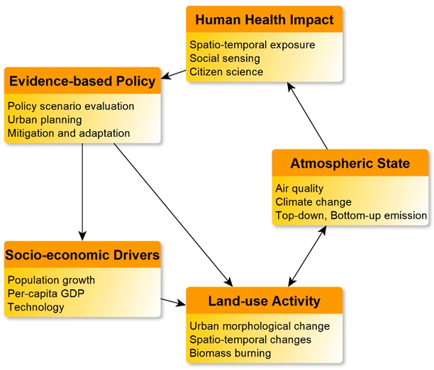
Research Directions:
- Land-use change: Characteristics of volumetric urban growth, building functions as well as rural land-use change. How are these shaped by socio-economic drivers?
- Environmental impact: Spatio-temporal variations of pollutants, trace gas concentrations and emissions? How physical land-processes regluate this?
- Health impacts: Environmental and socio-economic factors influencing individual exposure and vulnerability? Modelling acute and chronic exposure/impacts by combining satellite and portable sensors measurements.
- Infrastructure monitoring: What is the impact of environment on infrastructure health and safety?
Direction 1. Characterizing urban-rural land-use changes
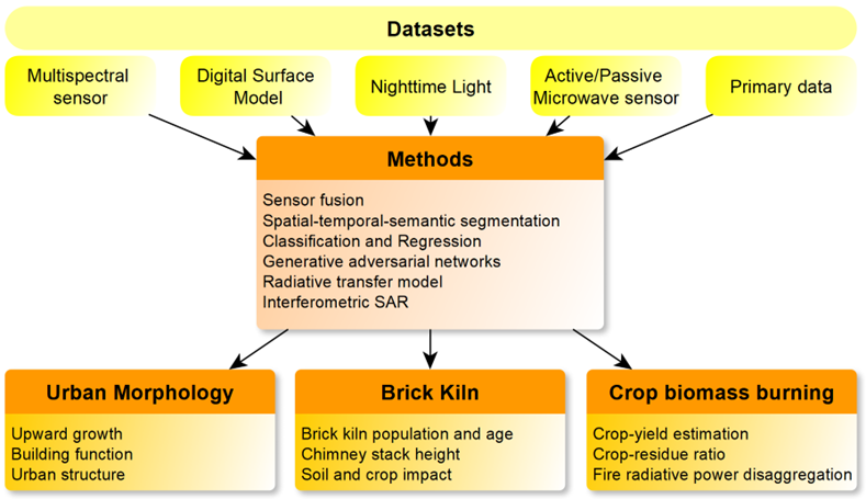
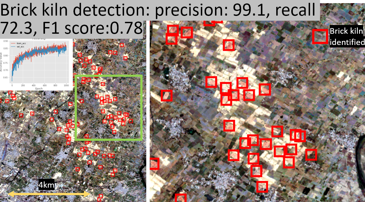 | Identification of Brick Kilns using Sentinel-2 Imagery [Misra et al. 2020 ISPRS IJGI] [Media coverage, Time of India] |
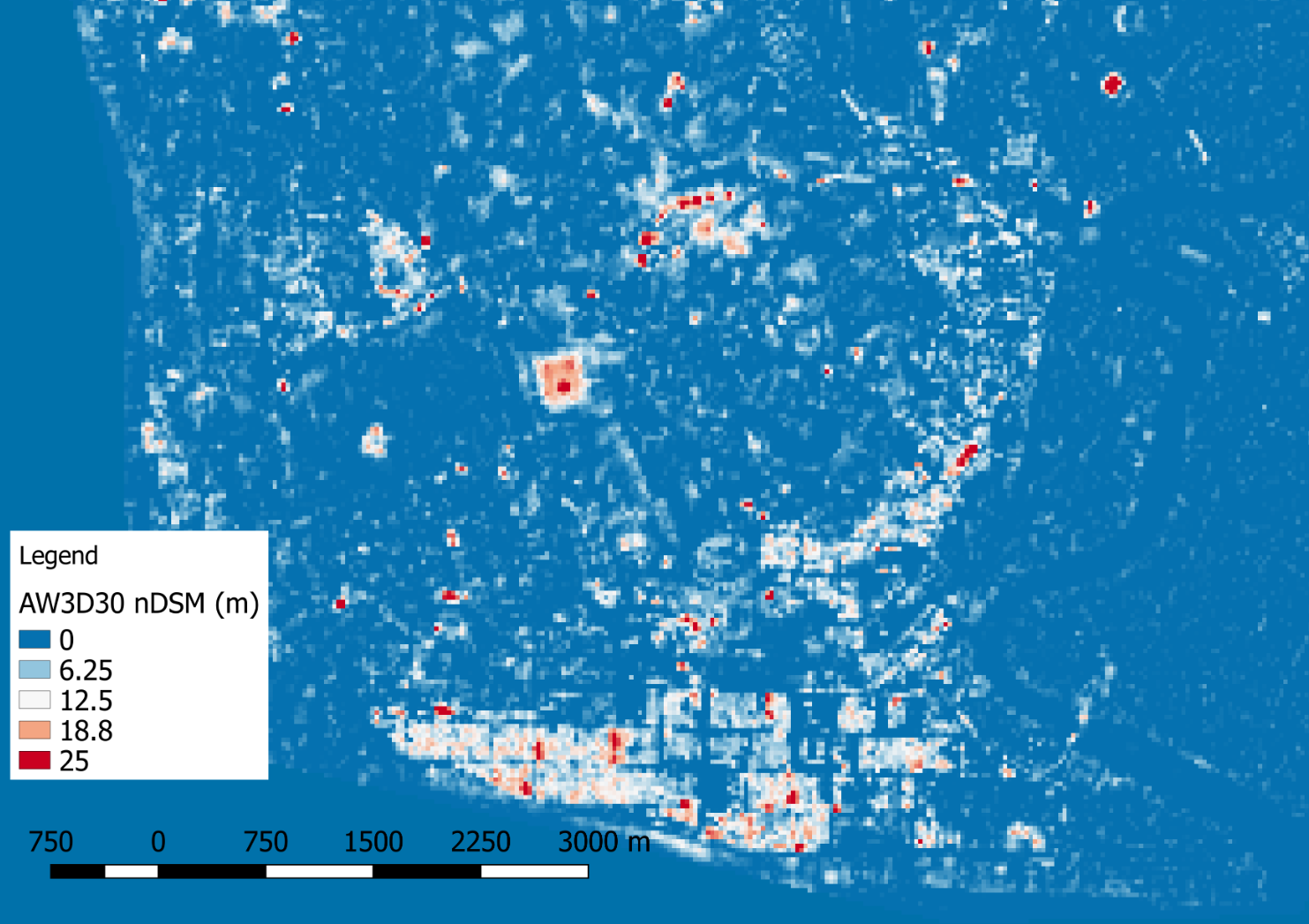 | Digital Building Height extraction from open Digital Surface Models [Misra et al. 2018 Remote Sens.] [Github] [GEE App] |
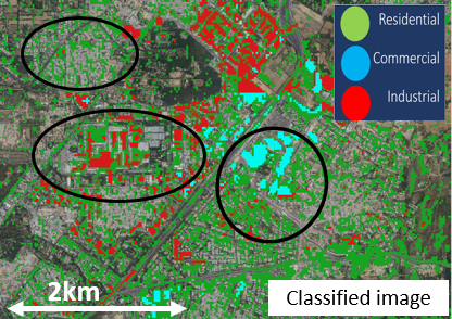 | Mapping Urban Land-use using Building Height and Nighttime Light [ResearchGate] [GEE] |
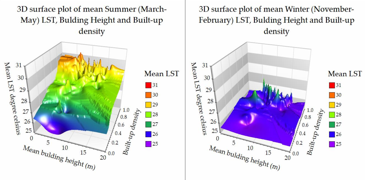 | Building-density and Urban Heat Island [Rahman et al 2020 Remote Sens.] |
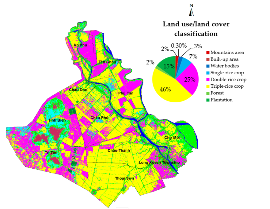 | Identification of Rice-crop Calendar [Minh et al. 2019 ISPRS IJGI] |
 | Identification of Conformity of Urban Land-use to Zoning Regulations [Rahman et al. 2021 Sust. Sci.] |
 | SAR and Optical based differ-modality learning to identify logging [Kambhampati et al. 2023 IGARSS] |
Direction 2. Modelling bottom-up and top-down environmental impacts
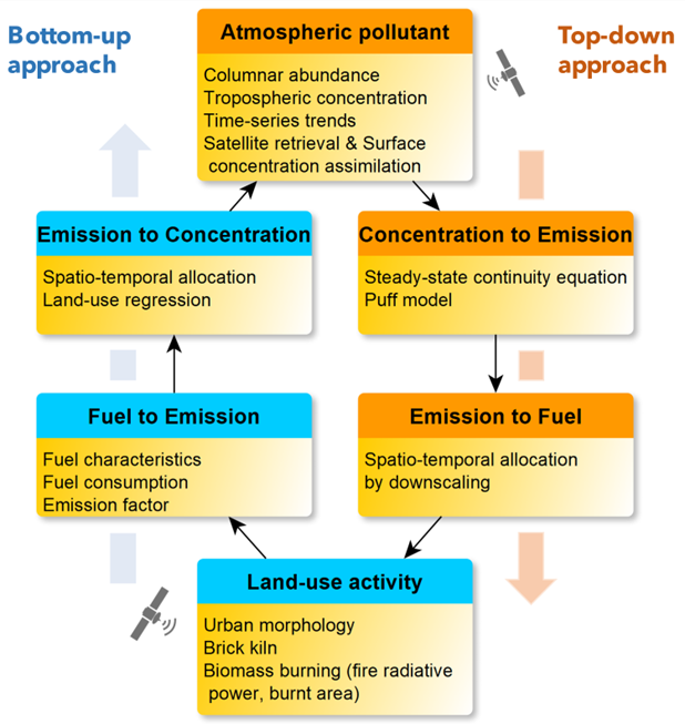
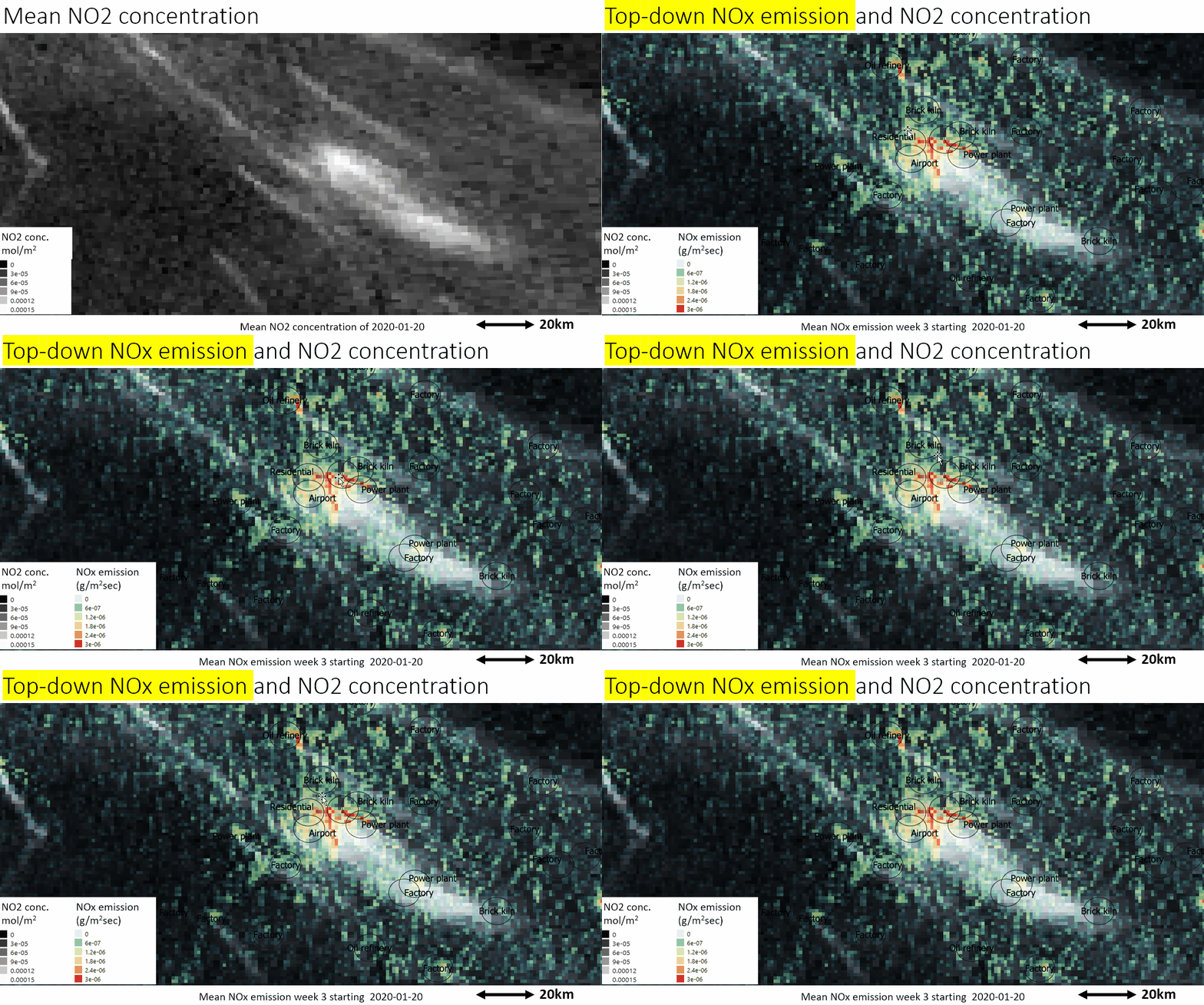 | Top-down NOx Emission estimation with special focus on COVID-locakdown [Misra et al. 2021 Nat. Sci. Rep.] [Media coverage, phys.org] |
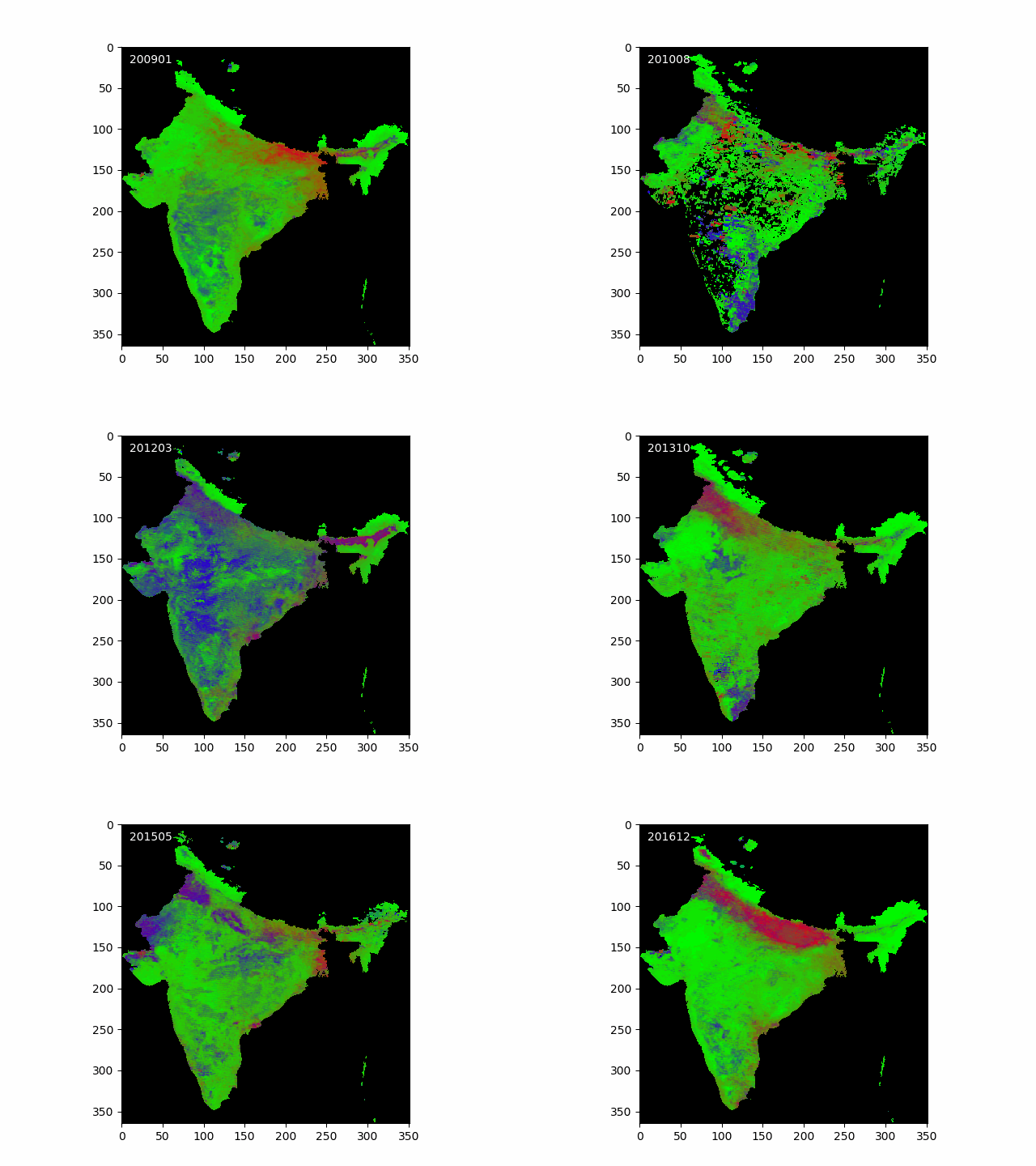 | Urban Air Quality (PM2.5) Indicator using Aerosol Optical Depth and Angstrom Exponent [Misra et al. 2017 Remote Sens.] |
 | Contribution of Changing Land-use to Urban Air Pollution [Misra et al. 2018 Atmosphere] |
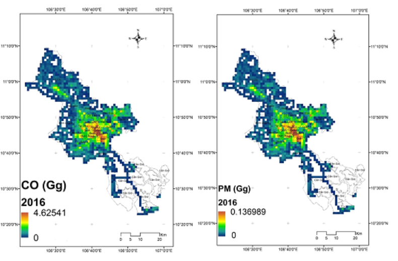 | Contribution of Changing Land-use to Urban Air Pollution [Trang et al. 2021 Atmos. Chem. & Phy.] |
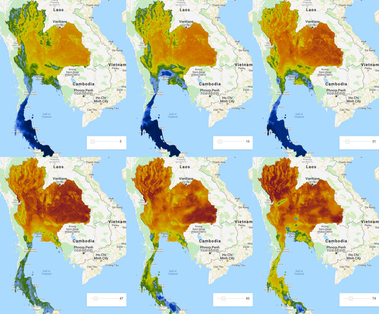 | Remote sensing based KBDI Meteorological Drought Index [GEE app] |
Direction 3. Mapping human exposure and health risk
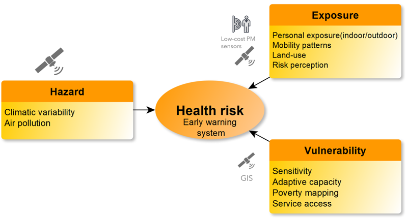
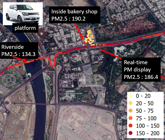 | PM2.5 personal exposure mapping using portable low-cost sensors [Presentation] |
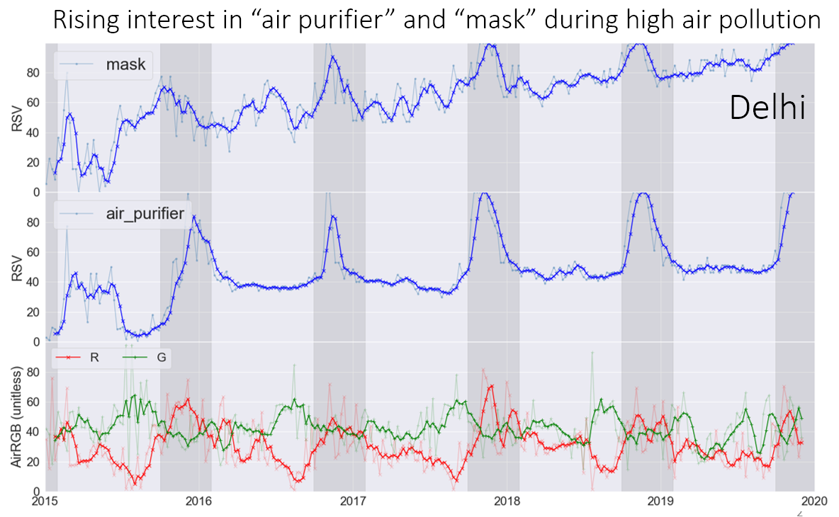 | Social sensing resident interest in air quality and health impacts across Asian cities [Misra & Takeuchi 2020 Int. Arch. PRSSIS] [Presentation] |
Direction 4. Infrastructure health monitoring
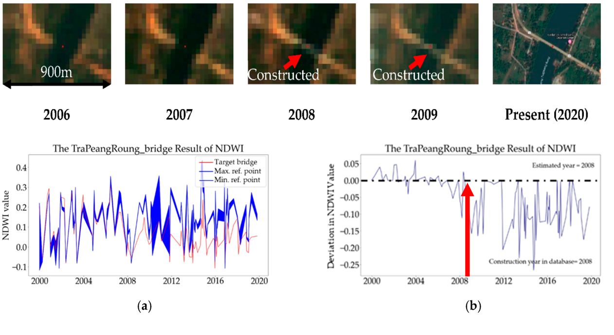 | Estimating construction year for bridges in developing country using NDWI time-series [Sovisoth et al. 2023 Infrastructure] |
| <img src="../images/research/inverseVelocity.png width="200" height="140" class="papericon"> | Detecting precursor onset of acceleration and time of failure in PS point time series using saliency and inverse velocity [Chavhan et al. 2023 IGARSS] [Global patent 1] [Global patent 2] |
 | Estimating bridge construction year using NDWI | |
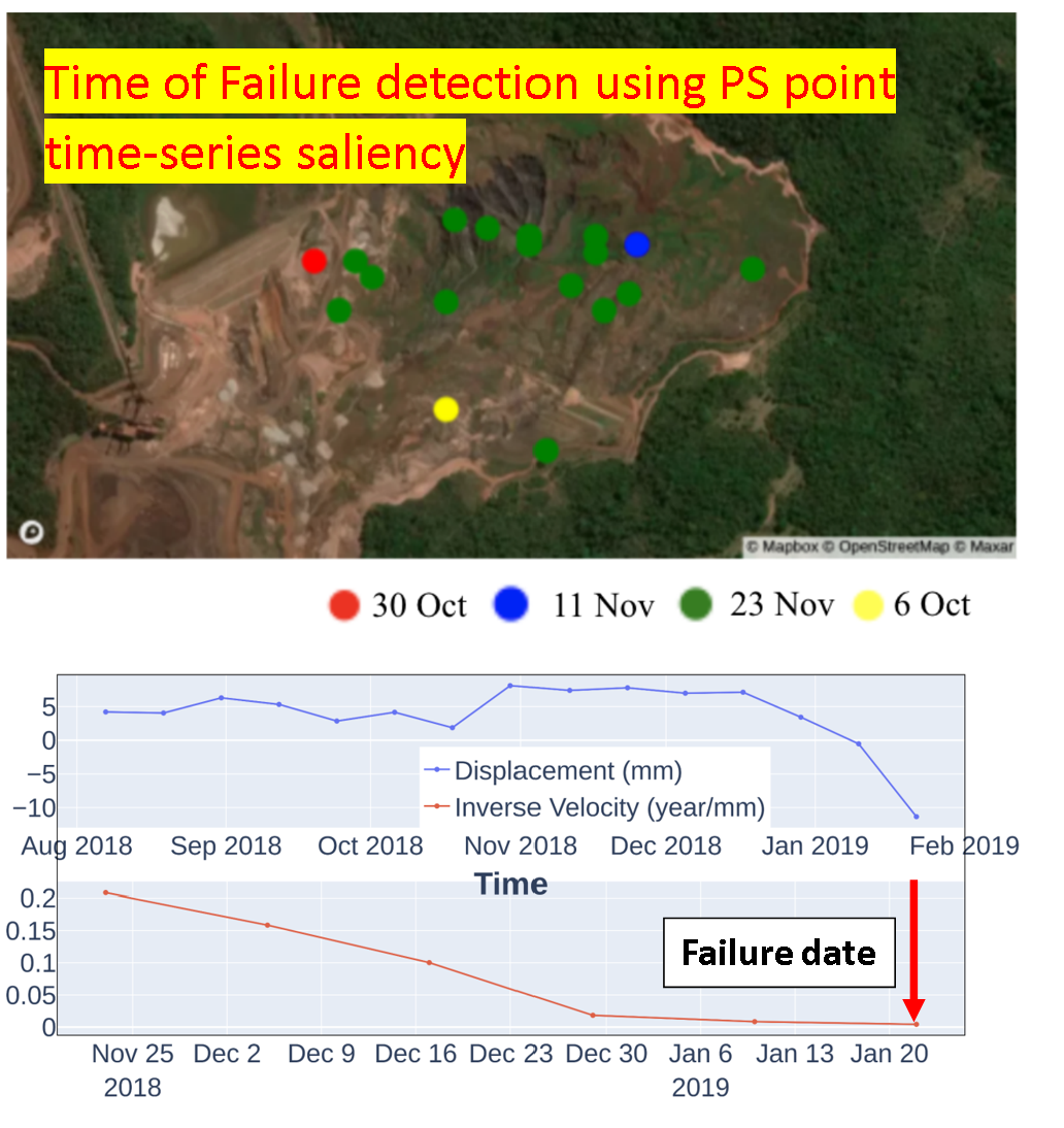 | Detecting precursor onset of acceleration and time of failure in PS point time series using saliency and inverse velocity |
